
For every ride with a bike computer
Know what's ahead. Even with no signal.
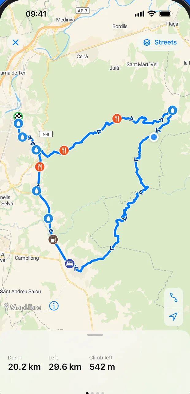
Ridekit adds what a route file doesn't tell you: where to find water and food, the climbs, the weather where you'll be, places to stay and an offline map. Before the ride and during it. The route then goes onto your bike computer, whichever you ride: Wahoo, Hammerhead, Bryton, Garmin and others.
Free to start. iPhone, iOS 17 or later. Works with any bike computer that takes a FIT or GPX course.
- KM 0
Collect
Open routes from any app, website, email or friend. Any file.
- KM 1
Get ready
While there's internet: offline map, stops, places to stay, weather.
- KM 2
Send and ride
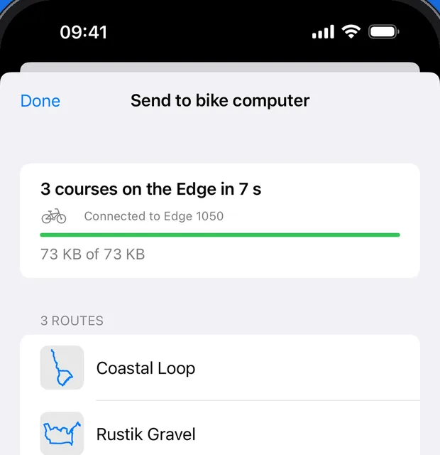
To your bike computer: over Bluetooth to a Garmin Edge, or as a FIT or GPX file.
Your bike computer
On your bike computer, whichever you ride
Garmin Edge? Ridekit sends the course straight to it over Bluetooth, with no internet, even mid-ride. Wahoo, Hammerhead, Bryton or another? Export a FIT course or a GPX with your stops and open it in your bike computer's app.
- Your stops and controls go along as course points
- Several routes at once
- Big routes made light so your bike computer keeps up
Library
Every route on your phone, not on your bike computer
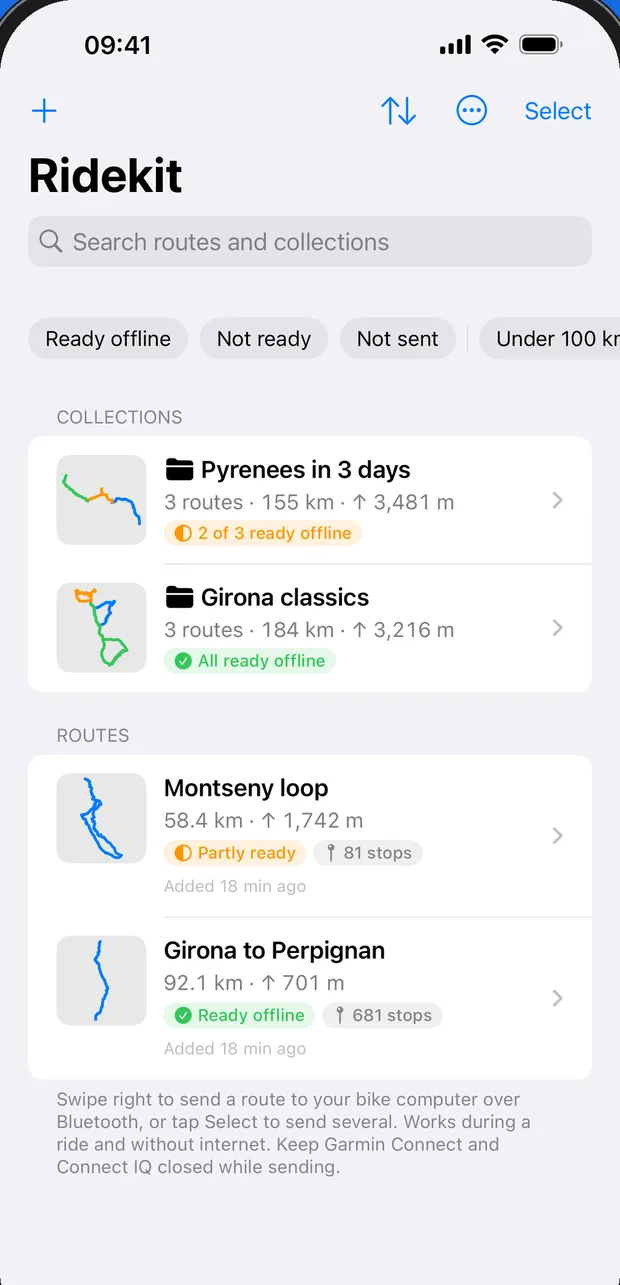
A club's GPX, a friend's FIT, an export from your favourite planner: open them all in one library. Look them over on the big screen and send only the one you need today. Your bike computer stays light and quick.
- GPX, FIT, TCX, KML, KMZ, or a zip of them
- Collections for trips and events
- Spots routes you already have
Stops
Water and food before you need them
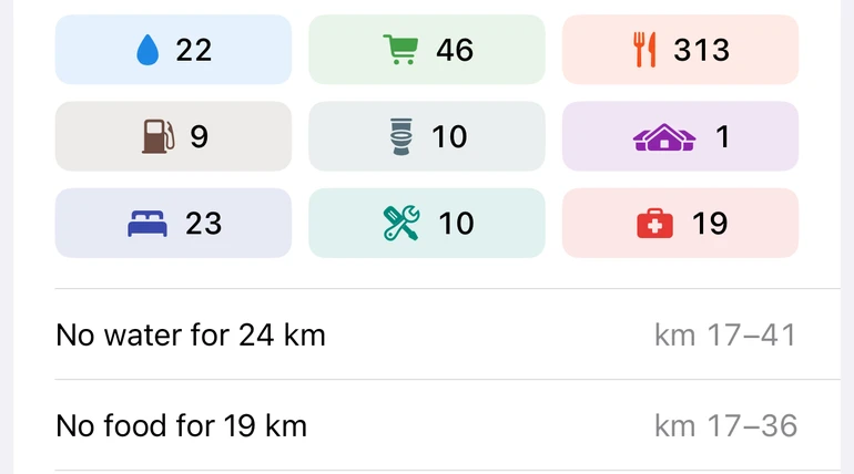
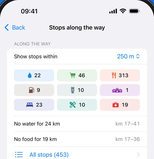
Drinking water, cafés, shops, toilets and bike repair along the route, found in seconds and kept for no signal. See "No water for 24 km" while there's still time to fill up.
- Add a stop and it shows up ahead on your bike computer
- Distances along the route, not as the crow flies
- From OpenStreetMap, kept up to date by riders
Multi-day
Ready for no signal, stage by stage
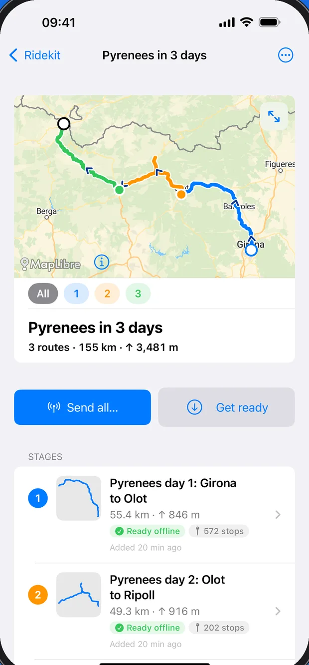
Put a trip's routes in a collection, or split a long route into stages at good stops. Get ready saves the map, the stops and the places to stay for every stage while you have internet; then each day works with no signal.
- Send every stage at once
- Get the whole trip ready in one tap
- Collections and stages come with Pro or Plus
Big routes
Huge files, made light
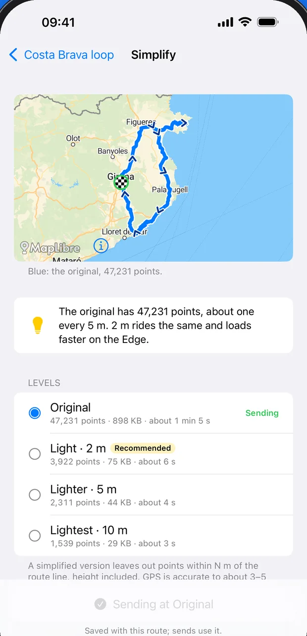
A 240 km route with 47,000 points goes from a minute to 6 seconds at 2 m detail, and rides the same. Pick the detail on the Send page; the original is always kept.
- Your bike computer won't slow down on long routes
- See on the map where a lighter copy cuts a corner
And on the ride
Everything for a great day out
Climbs
Every climb, found the way bike computers find them, with length, gradient and category.
Find a bed
Hotels, hostels and campsites where you'll be in two hours. Free, and offline after Get ready.
Weather where you'll be
Hour by hour along the route: headwind, rain and when it gets dark.
Your ride on the Lock Screen
Km left, the next water and food, and the climbing still to come, without opening the app.
Share with a rider
AirDrop a route to a friend with its map and stops. No signal needed.
Offline maps
The map along the whole route, saved by Get ready. Streets and Dark for everyone; Topo and Terrain with Pro or Plus.
Guides
Rides Ridekit helps with
Send a route to your Garmin Edge with no internet
Ridekit sends courses from your iPhone to your Edge over Bluetooth: no cable, no computer, no signal needed. Here's how, and what to do if Garmin Connect gets in the way.
Any rideChange your route mid-ride, with no signal
Plans change at a café: a headwind, a closed road, a shorter way home. Send a new course from your iPhone to your Garmin Edge during the ride, no internet needed.
Any rideRoutes from Komoot, Ride with GPS or Strava to your bike computer
Any route file from any app, email or link: open it in Ridekit and put it on your bike computer. GPX, FIT, TCX, KML, KMZ and zips, with duplicates spotted.
Any rideKeep every route on your phone, not on your bike computer
Keep your whole collection of routes in Ridekit, find any one in seconds, and put on your bike computer only the one you're riding today.
Garmin EdgeEdge slow with big GPX files? Send a lighter course
Some route files carry a point every metre. Choose a lighter detail level when you send: a 240 km route goes from a minute to 6 seconds, rides the same, and the original is kept.
Group ridesShare a route with your riding group, ready for no signal
Pass a route to another rider by AirDrop, with its stops, road surface, places to stay and offline map. No internet needed, on either phone.
Plans
Free to ride. More when you want it.
Free
- Send to a Garmin Edge, export FIT and GPX, import
- Water and food along every route
- Offline maps for routes up to 170 km, up to 500 km of new maps a week
- Climbs, Find a bed, towns, sharing
Pro one-time
- Every kind of stop: shops, toilets, bike repair, pharmacies…
- Offline maps for every route, Topo and Terrain
- Routes in 3D, collections, splitting into stages
Plus yearly or monthly
- Everything in Pro
- Weather along the ride, where you'll be, hour by hour
- 7-day free trial on the yearly plan
Own Pro already? The Weather add-on brings weather for a yearly or monthly price. Whatever your plan, what you've made stays yours. More about plans
Garmin Edge
Ride with a Garmin Edge? Send with no internet.
Ridekit talks to the Edge directly over Bluetooth: no cable, no computer, no Garmin Connect upload, no signal. Load the next course at a café halfway round, or abroad without roaming. Edge 540, 840, 1040, 550, 850 and 1050.
Ride without signal. Never without a route.